|
Future Travel Plans To Visit Jay In Faro? |
| A |
|
A Quick Potential Game Plan For The Trip. |
|
This would be
what I'm thinking for fuel stops only. I'd be travelling with a truck
and camper.
Starting from Prince George... |
|
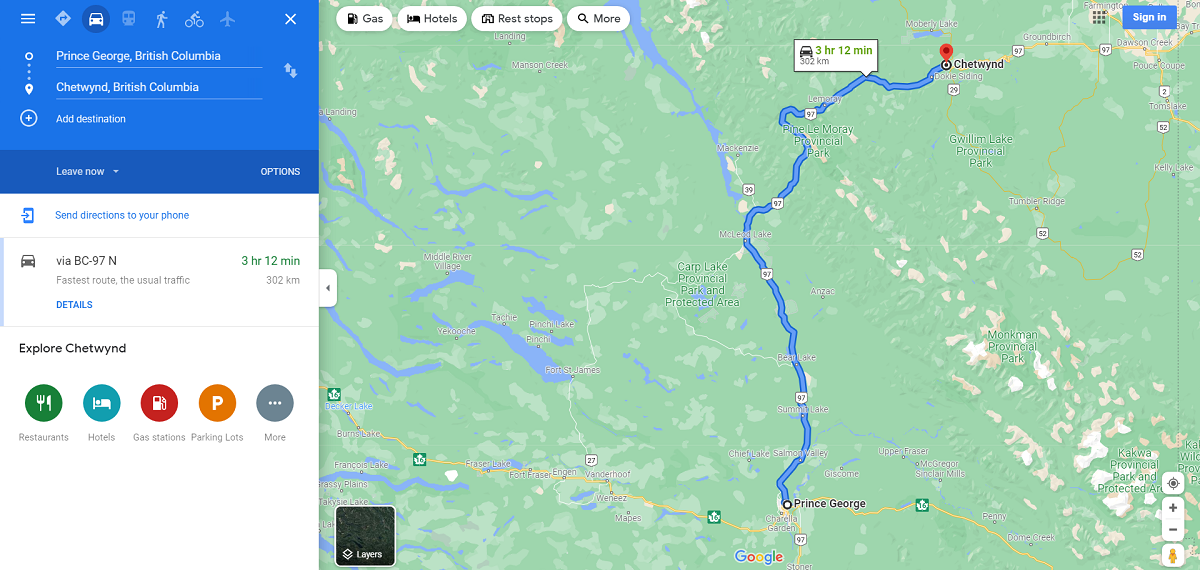
Travel from Prince George to Chetwynd. |
|
|
|
|
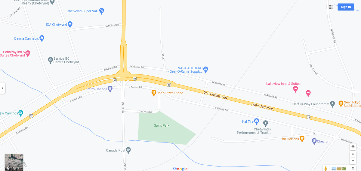
Fuel Stops in Chetwynd. |
|
|
|
|
|
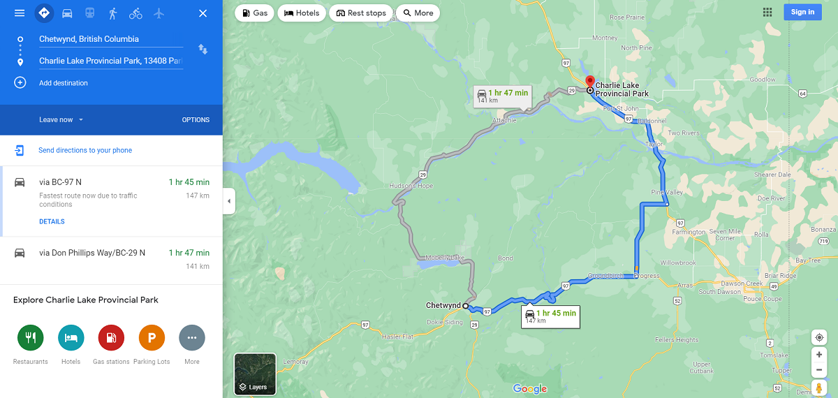
Travel from Chetwynd to Charlie Lake. |
|
|
|
|
|
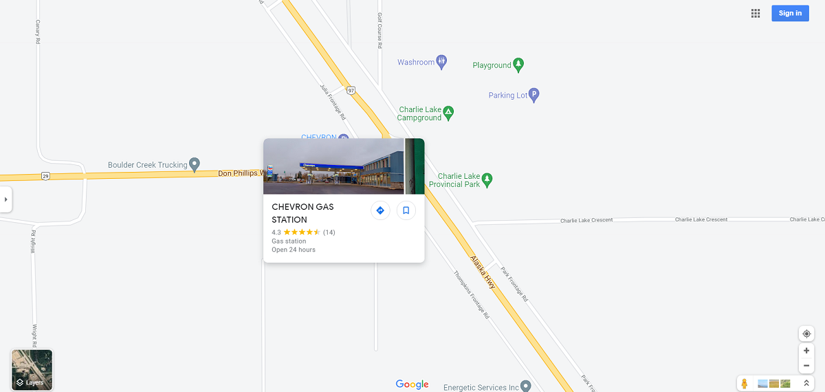
Fuel Stop in Charlie Lake. |
|
|
|
|
|
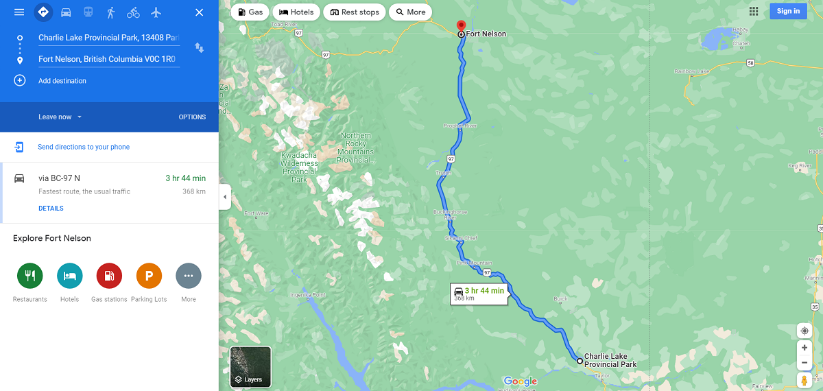
Travel from Charlie Lake to Fort Nelson. |
|
|
|
|
|
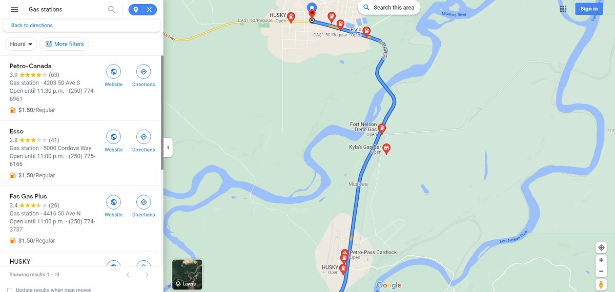
Fuel Stops in Fort Nelson. |
|
|
|
|
|
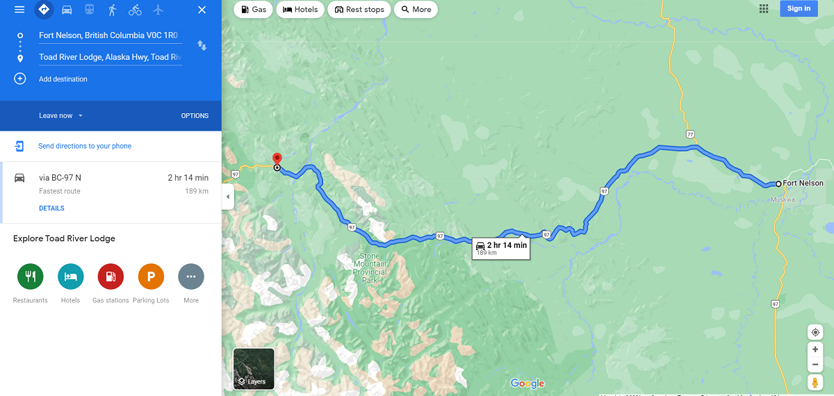
Travel from Fort Nelson to Toad River. |
|
|
|
|
|
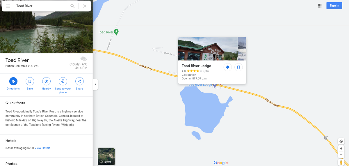
Fuel Stop in Toad
River. |
|
|
|
|
|
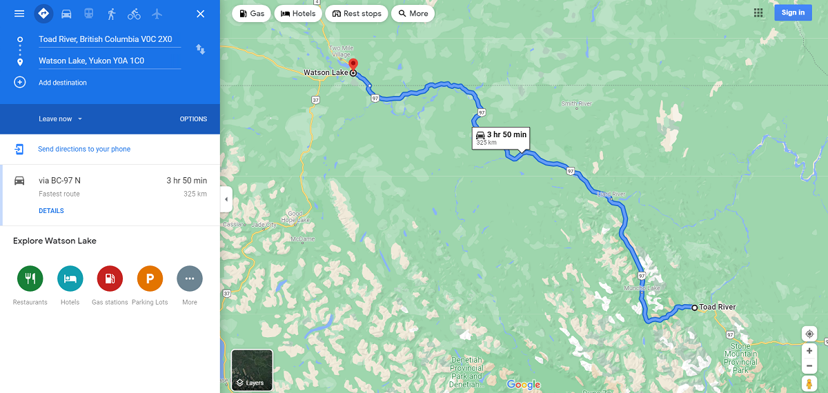
Travel from Toad River to Watson Lake. |
|
|
|
|
|
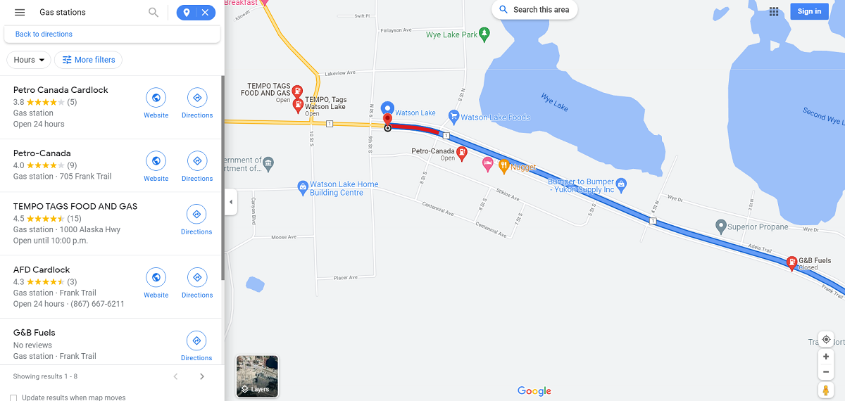
Fuel Stops in Watson Lake. |
|
|
|
|
|
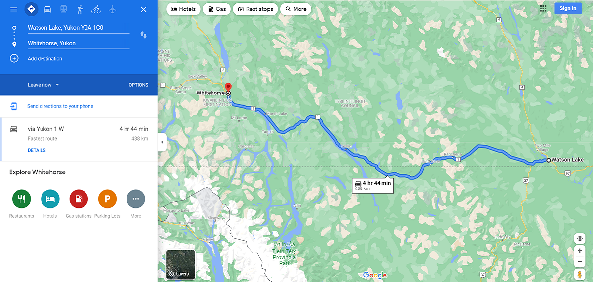
Travel from
Watson Lake to Whitehorse. |
|
|
|
|
|
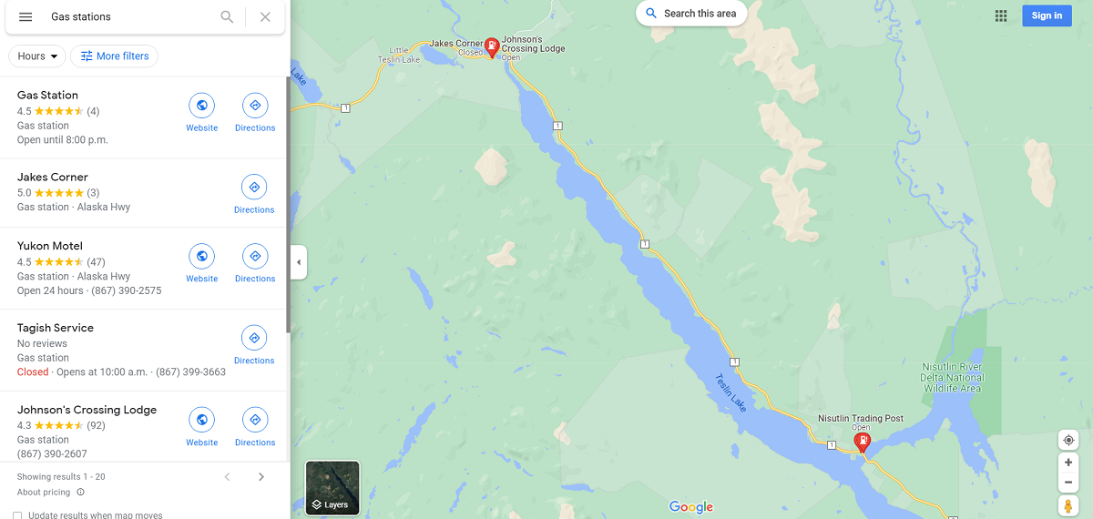
Fuel Stops between Watson Lake and Whitehorse if needed. |
|
|
|
|
|
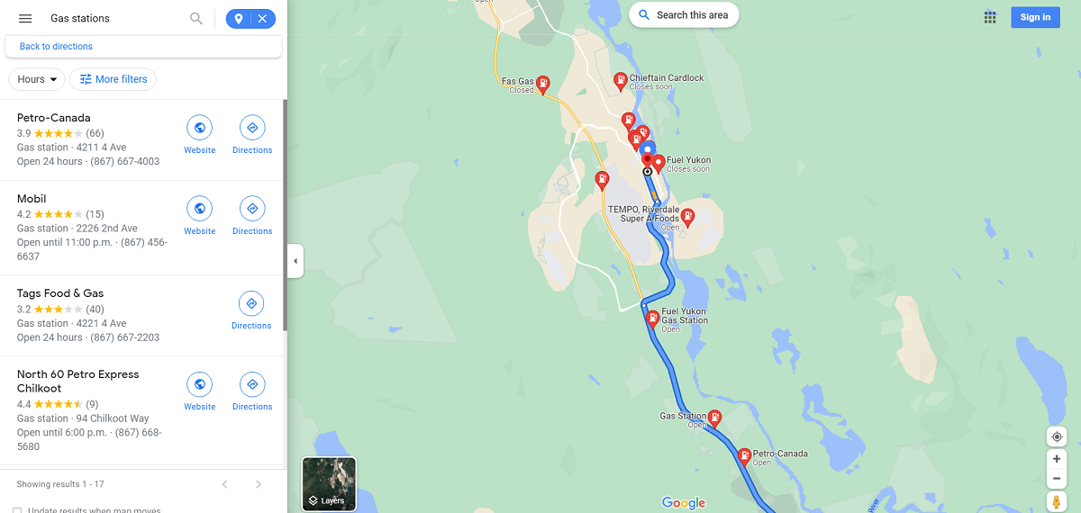
Fuel Stops in Whitehorse. |
|
|
|
|
|
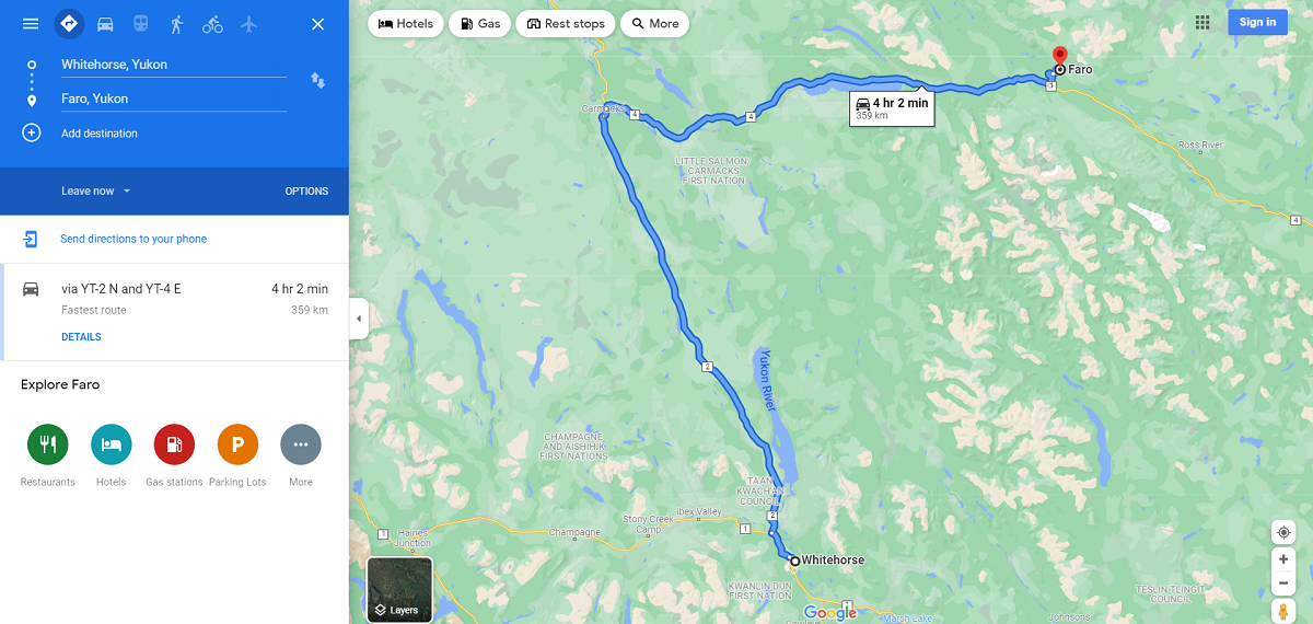
Travel from Whitehorse to Faro. |
|
|
|
|
|
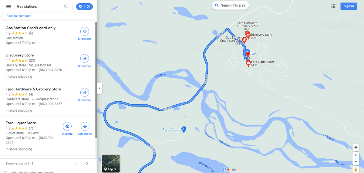
Fuel Stop in Faro. |
|
|
|
|
|
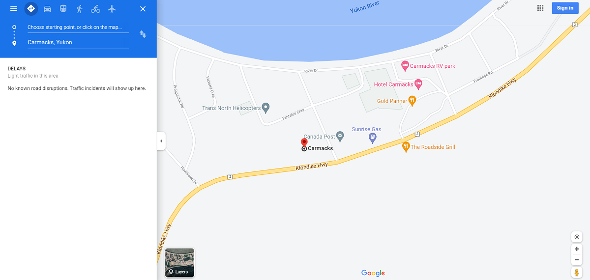
Fuel Stop in Carmacks... Approx half way between Whitehorse and Faro to play safe if needed. |
|
|
|
|
|
Alrighty then... I made a crazy spreadsheet if you would like some travel info. |
|
| View the spreadsheet here in PDF format from Kelowna | |
| View the spreadsheet here in PDF format from Kamloops | |
| I hope you find something here helpful.... Cheers. | |